Best Lauterbrunnen Travel Guide 2026: Switzerland’s 72 Waterfalls Paradise
By TravelguidestipUpdated 13 min readHow we earn
Hotel buttons open Stay22 (Booking.com, Agoda and others) and tour buttons open GetYourGuide. We may earn a commission at no extra cost to you.
In short
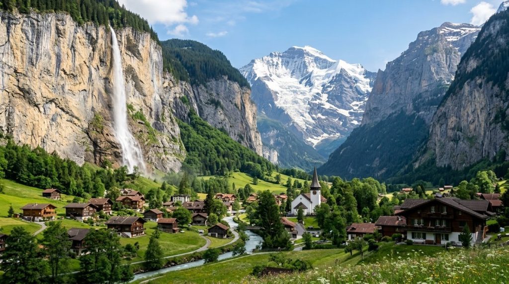
- Staubbach Falls (free) plunges 297 meters from an overhanging cliff directly behind the village. A footpath climbs behind the falls in summer. Bring a rain jacket. The mist is not gentle.
- Trummelbach Falls (12 CHF) is the only underground glacier-waterfall system in Europe accessible to the public. Ten cascades thunder through the mountain interior. The noise alone justifies the entry fee.
- The Lauterbrunnen-to-Stechelberg valley trail runs 8 kilometers on flat ground with unobstructed waterfall views the entire way. Zero fitness required, maximum landscape payoff.
- The cable car to Grutschalp (included in Swiss Travel Pass) opens onto a car-free alpine terrace with panoramic Eiger, Monch, and Jungfrau views. The 9-kilometer walk to Murren is the best easy hike in the region.
- Lauterbrunnen vs Grindelwald comes down to one question: do you want vertical drama and waterfalls (Lauterbrunnen), or a wide sunny bowl beneath the Eiger north face with more restaurants and gondolas (Grindelwald)?
Lauterbrunnen Valley: Switzerland’s 72 Waterfalls Paradise (2026)
This Lauterbrunnen travel guide covers everything you need to plan your trip in 2026. > **** We have visited the Lauterbrunnen valley across every season from spring snowmelt to winter frost. The recommendations below come from direct experience on these trails.
The first thing you notice in Lauterbrunnen is the sound. It is not a single waterfall — it is a chorus. Waterfalls spill off the cliff edges on both sides of the valley, some full and thundering, others thin ribbons of mist that dissolve before they hit the ground.
Seventy-two of them, by the official count from Switzerland Tourism, thread their way down vertical walls rising 300 meters on either side of a glacial trough barely a kilometer wide.
J.R.R. Tolkien hiked the Lauterbrunnen Valley in 1911 at age 19. Twenty-some years later, he based Rivendell, the Elven refuge in The Lord of the Rings, on this valley.
You can see it instantly: the hidden sanctuary between sheer walls, the waterfalls, the sense that you have wandered into a protected place where the outside world’s rules do not quite apply.
This Lauterbrunnen travel guide covers the waterfalls that define the valley, the hikes that earn the views, the photo spots worth waking up for, how Lauterbrunnen compares to neighboring Grindelwald, and the practical details of getting here and getting around.
We only recommend services we have experienced firsthand or researched thoroughly. Learn more.
The Best Waterfalls in Lauterbrunnen
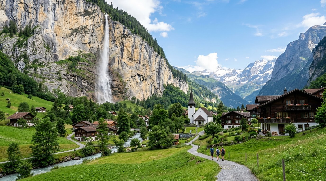
The 72 waterfalls are the reason the valley exists as a destination. Here are the five that define it.
Staubbach Falls
Staubbach is the valley’s signature. The water drops 297 meters from an overhanging rock face directly behind the village, free-falling with no contact against the cliff. The name translates to “dust stream,” because the water atomizes into a fine mist long before it hits the ground. Goethe visited in 1779 and wrote a poem about it. The poem is forgettable. The waterfall is not.
A footpath carved into the cliff behind the falls climbs to a viewing gallery roughly one-third of the way up. In summer (May through October), the path is open daily from 9:00 AM to sunset. The mist soaks everything within 50 meters.
Cameras require protection. The view through the falling water, looking out across the green valley floor to the opposite cliff wall, is one of the most elemental experiences in the Swiss Alps.
Trummelbach Falls
Trummelbach is Staubbach’s opposite in every respect: hidden instead of visible, thundering instead of misting, expensive instead of free. It is also the most geologically singular waterfall in Switzerland and worth every one of the 12 CHF it costs to enter.
Ten glacier-fed waterfalls cascade through the interior of the mountain, draining the meltwater from the Eiger, Monch, and Jungfrau glaciers — roughly 20,000 liters per second in summer. An elevator built into the rock lifts visitors to the upper galleries, where you walk through tunnels and platforms to witness the water tearing through sculpted limestone chutes. The noise is physical. You feel it in your chest before you see it. The wooden walkways vibrate.
Open April through November. Go at 9:00 AM before the bus tours from Interlaken arrive at roughly 10:30 AM. The experience with five people and the experience with 50 people are fundamentally different.
Murrenbach Falls
Murrenbach, across the valley from Staubbach, is the highest single-drop waterfall in Switzerland at 417 meters. It receives far less attention than the valley’s more famous cascades because it is harder to reach: a steep 45-minute hike from the Stechelberg valley floor, or visible distantly from the Grutschalp-Murren walking path above. The effort filters out the casual waterfall tourist.
Photograph it from the Murren side of the valley for the best angle, ideally with a telephoto lens (200mm or longer) to compress the height against the cliff face.
Sefinen Falls
Sefinen pours off the eastern wall near Stechelberg, the last village in the valley. It is a multi-tiered cascade with a stone footbridge crossing directly in front of the middle section.
The bridge is 90 minutes walking from Lauterbrunnen station and worth the effort for the close-up angle — you can stand close enough that the spray cools your face on a hot day. Almost no tour groups reach this point.
Sprutz and Talibach Falls
These two come as a pair above Stechelberg, reached by cable car from the valley floor to the Schilthorn route. Sprutz drops off the Murren plateau in a long, thin ribbon. Talibach crashes through a narrow gorge next to the cable car station.
Both are best viewed from the hiking trail connecting the Schilthorn cable car’s middle station to the valley path below. The combined loop from Stechelberg takes about 2.5 hours.
Best Hiking Trails in the Valley
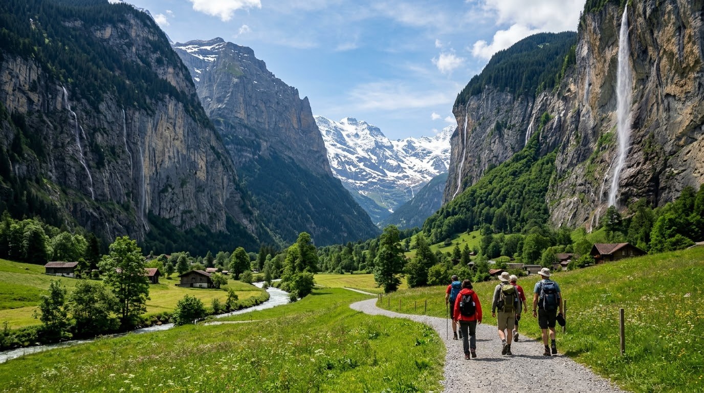
Lauterbrunnen’s hiking ranges from a flat valley-floor stroll to alpine routes that climb above the tree line. The valley floor is accessible to everyone. The higher trails reward fitness with panoramas that define the Swiss Alps in the global imagination.
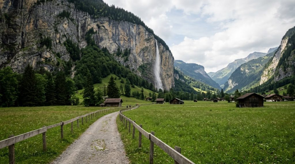
The Valley Floor Trail (Lauterbrunnen to Stechelberg)
This is the hike for people who do not want to hike. Eight kilometers of flat, paved path along the valley floor, with waterfalls tumbling off both cliff walls the entire way. The path passes through small hamlets, past the Trummelbach falls entrance, and ends at the Stechelberg cable car station. A bus runs the same route (Line 141) if you prefer to walk one way and ride back.
Walking time: 2 hours one-way. Waterfalls visible directly from the path include Staubbach, Murrenbach, Trummelbach, and several unnamed cascades that appear only after heavy rain. The valley floor catches morning light best from 8:00 AM to 11:00 AM, when the sun angle illuminates the waterfalls without backlighting the cliffs.
Grutschalp to Murren (The Alpine Terrace)
Take the cable car from Lauterbrunnen to Grutschalp (three minutes), then walk the Mountain View Trail to Murren. The path is wide, flat, and graded at a gentle 2%, passing through wildflower meadows with the Eiger, Monch, and Jungfrau filling the entire southern horizon. The Jungfrau massif appears so close from this angle that you feel like you could reach out and touch the snow.
Walking time: 1 hour 30 minutes. Distance: 9 kilometers. The path is stroller-accessible. The best section runs between Grutschalp and Winteregg, where the valley opens up to reveal the full Jungfrau panorama. A restaurant at Winteregg station serves rosti with a view that would be the centerpiece of any other hiking trail in the world. Here, it is just another lunch stop.
Obersteinberg and the Oberhornsee
The most ambitious day hike from the valley climbs to the Obersteinberg Berghotel, a 19th-century alpine inn at 1,778 meters with no road access, no electricity, and a view of the Breithorn glacier that justifies the 1,100-meter vertical climb. Beyond the hotel, the trail continues 45 minutes to the Oberhornsee, a small alpine lake that perfectly mirrors the Jungfrau when the wind is still.
The round-trip from Stechelberg takes 5-6 hours with roughly 1,100 meters of elevation gain, placing it firmly in the “serious day hike” category. The hotel serves lunch to hikers on its terrace (cheese and bread plates, 18 CHF) with a view of the glacier calving into the valley below. Overnight stays in dormitory rooms cost 70 CHF including dinner and breakfast. Book at least two weeks ahead for summer weekends.
The North Face Trail (Murren to Schilthorn)
For hikers who want the Eiger north face experience without the technical climbing, the North Face Trail from Murren descends below the Schilthorn cable car with direct views of the Eiger’s most infamous wall. The trail loops 7 kilometers with moderate elevation change.
Panels along the route recount the history of attempts on the north face, from the first successful ascent in 1938 to the present. The combination of reading about climbers dying on the wall while walking through a gentle alpine meadow beneath it is uniquely Swiss.
Find your Interlaken hotel on the map
Live prices from Booking & Airbnb — tap a pin to compare stays around Interlaken and the Jungfrau region and beyond.
Most Photogenic Spots in Lauterbrunnen
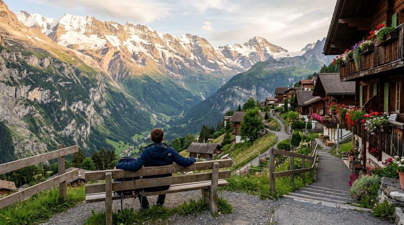
Lauterbrunnen photographs differently depending on the time of day, the season, and the angle. These are the spots that consistently deliver.
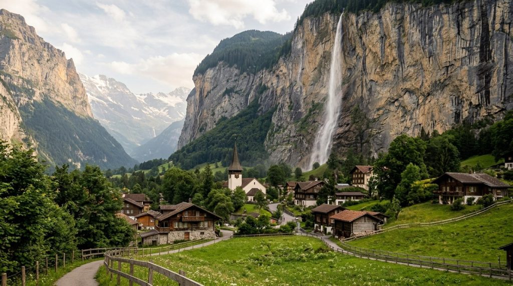
The Classic: Lauterbrunnen Church with Staubbach
Stand on the main street (Fuhren) roughly 100 meters south of the church, facing north. The church steeple fills the left foreground, the Staubbach Falls the right, and the narrowing valley leads the eye toward Interlaken in the distance. Morning light (before 10:00 AM in summer) illuminates the falls. Autumn adds yellow larch trees on the valley walls. A 35mm lens frames the composition perfectly.
The Reflection: Staubbach in the River
Behind the church, the Weisse Lutschine river runs through a small park where the water slows into a pool. On windless mornings, the Staubbach reflects perfectly on the surface. Lie on the grass at the riverbank to bring the camera as low as possible, maximizing the reflection. A polarizing filter cuts the surface glare. Arrive by 7:30 AM in summer for the best light before the breeze picks up.
The Power Shot: Inside Trummelbach
Trummelbach’s interior galleries are dark, wet, and constantly moving. A tripod is prohibited inside (the walkways are too narrow), but a camera with good high-ISO performance (ISO 3200 or higher) and a fast lens (f/2.8 or wider) can capture the waterfalls with detail. The upper gallery, where the water explodes through a natural rock window, is the most dramatic single composition. Brace against a wall and shoot at 1/500th or faster to freeze the water.
The Valley from Above: Grutschalp Panorama
From Grutschalp, five minutes above Lauterbrunnen by cable car, the valley spreads below like a geological diagram. The two parallel cliff walls, the green floor with its checkerboard of pastures, and the silver threads of a dozen waterfalls. A telephoto lens (70-200mm) isolates individual waterfalls against the dark cliffs. Morning mist rising from the valley floor is the element that elevates this shot from postcard to magazine cover.
The Secret: Isenfluh
Isenfluh is a hamlet of roughly 50 people perched on a ledge 400 meters above the valley floor, reachable by a post bus from Lauterbrunnen station. The road up is a series of hairpin turns that the bus driver navigates with the casualness of someone checking their phone.
At the top, a single guesthouse serves coffee on a terrace that faces directly into the Breithorn’s north face. From here, you can photograph the entire Lauterbrunnen Valley from an angle that appears in roughly zero travel guides. The Breithorn glacier hanging above the Sulwald valley is the foreground. The Eiger is off to the left. The silence at Isenfluh is absolute.
Lauterbrunnen or Grindelwald: Which to Choose
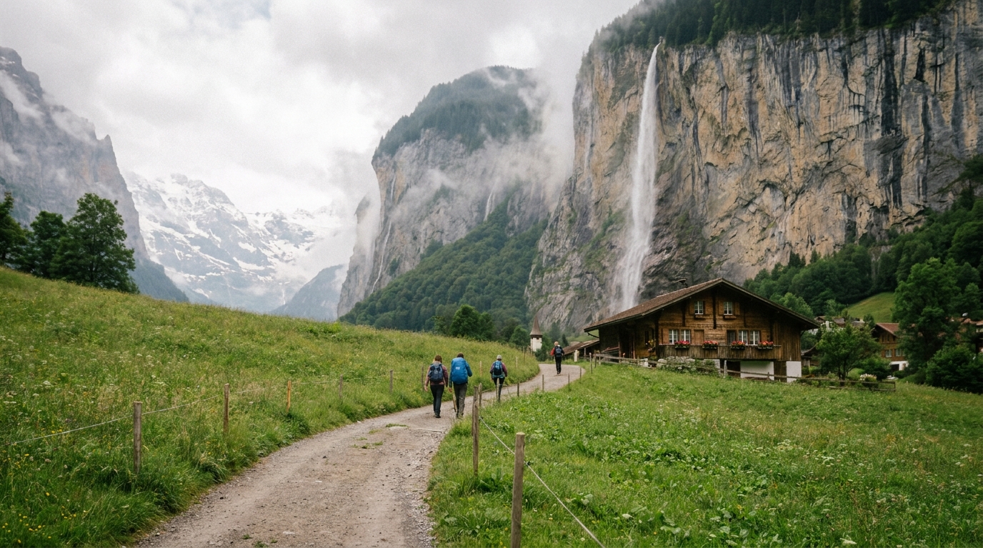
Both valleys sit in the same mountain range, separated by a single ridge, and the train between them takes less than an hour. But they offer fundamentally different experiences. The choice matters because your base determines which landscapes you wake up to.
Choose Lauterbrunnen If…
You want vertical drama. The valley walls rising 300 meters on both sides create an intimacy that Grindelwald’s wide bowl cannot match. The waterfalls are the differentiator. Lauterbrunnen feels like a hidden refuge. Grindelwald feels like a resort town that happens to sit beneath a famous mountain.
Lauterbrunnen is also the gateway to Murren, the Schilthorn, and the car-free alpine villages that dot the plateau above the valley. If your Switzerland fantasy involves walking through wildflower meadows with the Eiger on one side and waterfalls on the other, Lauterbrunnen is your base.
The downside: Lauterbrunnen is a one-street village with limited restaurants and nightlife. After 9:00 PM, the only sound is the waterfalls. Some people find this perfect. Others find it isolating.
Choose Grindelwald If…
You want more infrastructure, more restaurant choices, and direct access to the Jungfraujoch railway. Grindelwald is larger, sunnier (the valley orientation catches more afternoon light), and has a broader range of activities including the First Cliff Walk, the Eiger Trail, and extensive network of family-friendly gondolas.
Read our detailed Grindelwald guide for activity recommendations, the First Cliff Walk experience, hiking trails, and winter skiing information. Grindelwald works better for families and anyone who prefers a gondola to a hiking boot.
The Best Answer: Do Both
The train between Interlaken, Lauterbrunnen, and Grindelwald forms a triangle with each leg taking under 40 minutes. Base yourself in Interlaken for the most transport flexibility, then day-trip into each valley for the specific experiences you want: Lauterbrunnen for waterfalls and the valley floor walk, Grindelwald for the Eiger Trail and the First gondola network. Read our Interlaken guide for how to make the hub-and-spoke approach work.
How to Get There & Getting Around
Arriving by Train
Lauterbrunnen is the terminus of the Bernese Oberland Railway from Interlaken Ost, a 20-minute journey along the Lutschine River with the valley walls closing in as you approach. Trains depart hourly from roughly 6:00 AM to 10:00 PM. The journey is included in the Swiss Travel Pass. The station sits at the head of the main street, a 90-second walk to the first waterfall view.
From Zurich Airport, the journey takes roughly 2 hours 45 minutes with a change at Bern and Interlaken Ost. From Geneva, 3 hours 30 minutes with changes at Bern and Interlaken.
Getting Around the Valley
The valley has one main road served by PostBus Line 141, running from Lauterbrunnen station to Stechelberg (the cable car station for the Schilthorn) with stops at the Trummelbach Falls entrance. Buses run every 30 minutes in summer, hourly in shoulder seasons. The fare is 4.20 CHF, or free with the Swiss Travel Pass.
The Lauterbrunnen-Grutschalp cable car departs from directly opposite the train station (3 minutes, every 15 minutes in summer). From Grutschalp, the train to Murren runs every 30 minutes. The entire Grutschalp-Murren route is car-free. The Schilthorn cable car from Stechelberg ascends in four stages to 2,970 meters.
Where to Stay
Lauterbrunnen has three lodging tiers, all on the same single street:
Hotel Silberhorn: The best hotel in the valley proper, facing Staubbach Falls from the main street. From 200 CHF ($220 USD) per night. Rooms with valley-facing balconies book out months ahead.
Hotel Oberland: Mid-range on the main street, established 1908, with a restaurant serving fondue on a terrace facing the falls. From 150 CHF ($165 USD).
Camping Jungfrau: Europe’s most dramatically situated campground, at the foot of Staubbach Falls. Tent pitches from 25 CHF ($28 USD). The sound of the waterfall at night is free.
Book all properties: Booking.com. For a car-free alpine village experience, also consider hotels in Murren, reachable by cable car from the valley. Murren properties include the Hotel Eiger (from 250 CHF) with Matterhorn views from the spa.
Lauterbrunnen is not a checklist destination. It is a place you stand still in while waterfalls fall around you. Walk the valley floor. Climb behind Staubbach. Feel Trummelbach in your ribcage. Take the Grutschalp cable car up and walk to Murren. And when the sun drops behind the western cliff and the valley fills with shadow while the peaks above still glow, understand why Tolkien never forgot this place.
Continue your Swiss Alps journey with our guides to Interlaken, Grindelwald, and Zermatt and the Matterhorn.
Frequently Asked Questions
How many days do I need in Lauterbrunnen?
Budget two full days minimum. One day for the valley floor walk, Staubbach Falls, and Trummelbach. One day for the Grutschalp-Murren alpine terrace hike and the Schilthorn cable car. Three days allows the Obersteinberg hike or a day trip to Jungfraujoch.
Is Lauterbrunnen expensive?
Like all Swiss destinations, yes, but less than Zermatt or St. Moritz. Budget 120-180 CHF ($130-200 USD) per day per person including mid-range hotel, three meals, and activities. Trummelbach Falls (12 CHF) and the Schilthorn cable car (108 CHF round-trip) are the main activity costs. The valley floor walk and Staubbach Falls are free.
What is the best time to visit Lauterbrunnen?
June through September for hiking and waterfall access. May and October are quieter but some higher trails remain snow-covered. The waterfalls peak in late June (Switzerland Tourism data, 2026) when snowmelt is strongest. Autumn (late September through October) brings golden larch trees and fewer visitors. The valley is accessible year-round but many mountain facilities close November through April.
How do I get to Lauterbrunnen from Interlaken?
Take the Bernese Oberland Railway from Interlaken Ost to Lauterbrunnen. The journey takes 20 minutes and trains depart hourly. The fare is included in the Swiss Travel Pass. The route follows the Lutschine River with valley walls closing in as you approach, one of the most scenic 20-minute train rides in Switzerland.
Is Lauterbrunnen better than Grindelwald?
It depends on your priority. Lauterbrunnen has waterfalls, vertical drama, and a more intimate valley feel. Grindelwald has more restaurants, better family infrastructure, and direct access to the Jungfraujoch railway. We recommend visiting both since they are less than 40 minutes apart by train through the connecting Kleine Scheidegg pass.
Can I visit the waterfalls in winter?
Staubbach Falls freezes partially from December through February, creating ice formations on the cliff face. The path behind the falls is closed in winter. Trummelbach Falls is open only April through November. The valley itself is beautiful in winter with snow-dusted cliffs, but the waterfall experience is primarily a spring-through-autumn attraction.
Book your Switzerland trip: GetYourGuide for Jungfrau tours, Booking.com for hotels, and Airalo for Switzerland eSIM from $6.